Information about fishing at River Thames, Romney Island including fishery location, fish species present, ticket type, and fishery controller. Part of a guide to angling in the River Thames.
Description
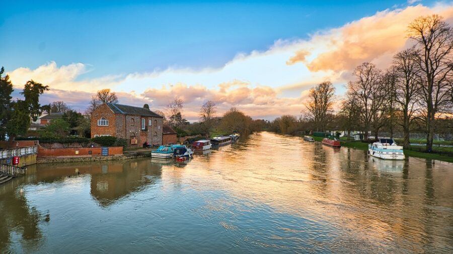
River Thames, Romney Island is a fishing venue on the Thames around half a mile in length supplying coarse angling via season ticket in the Windsor area. Species present include barbel, chub and pike. For the fishing club/owner’s webpage for this angling venue click HERE.
Use our species pages to find the fisheries that suit you: CARP, PIKE, TENCH, TROUT, CATFISH, BARBEL. Use search options for different categories such as day ticket, night fishing and season ticket.
Scroll to the foot of each page for Search and useful links.
Please contact us to add your fishery or angling club, or to have details updated or corrected. All listings are totally free.
If you like our content, why not see how you can Support This Website?
Species available in River Thames, Romney Island
SPECIES
PRESENT
TOP WGHT
CARP
PIKE
YES
22lb
CATFISH
TENCH
BREAM
BARBEL
YES
14lb
CHUB
YES
8lb
TROUT
GRAYLING
RUDD
DACE
ROACH
PERCH
CRUCIANS
EELS
GOLDEN ORFE
GEN CRSE FISH
Location
River Thames, Romney Island lies in the Thames east and downstream of Windsor in east Berkshire. The island lies just east of Eton and north of the Riverside railway station, close to the B470 Datchet Road. SL4 6HU
Information about fishing at River Thames, Clewer Meadow including fishery location, fish species present, ticket type, and fishery controller. Part of a guide to angling in Berkshire and the River Thames.
Description
The River Thames at Clewer Meadow is a fishing venue offering a prolonged stretch of the Thames near Eton Wick along with a smaller backwater. The venue offers coarse angling via season ticket for barbel, chub, bream, pike and the usual Thames species. Fishing is controlled by the Thames Valley Angling Association and is via local angling clubs who are affiliated such as Old Windsor Angling Club. For the fishing club/owner’s webpage for this angling venue click HERE.
Details
OWNER / CLUB:
Thames Valley Angling Association via affiliated clubs, including Old Windsor Angling Club
Use our species pages to find the fisheries that suit you: CARP, PIKE, TENCH, TROUT, CATFISH, BARBEL. Use search options for different categories such as day ticket, night fishing and season ticket.
Scroll to the foot of each page for Search and useful links.
Please contact us to add your fishery or angling club, or to have details updated or corrected. All listings are totally free.
If you like our content, why not see how you can Support This Website?
Species available in Clewer Meadow
SPECIES
PRESENT
TOP WEIGHT
CARP
YES
30lb
PIKE
YES
CATFISH
TENCH
BREAM
YES
BARBEL
YES
13lb+
CHUB
YES
7lb
TROUT
GRAYLING
RUDD
DACE
YES
ROACH
YES
PERCH
YES
CRUCIANS
EELS
GOLDEN ORFE
GEN. COARSE FISH
Location
The River Thames, Clewer Meadow fishing venue lies on the north bank of the Thames in north east Berkshire, north of Windsor. The fishery begins where the Boveney Ditch flows into the Thames south of Eton Wick (opposite the Windsor racecourse), and runs eastwards and downstream to the ‘Chinese Bridge’ where an off-flow from the Thames runs eastwards.
This off-flow is also available for fishing on this ticket, with angling permitted on the south bank up to the road bridge, and angling permitted on most of the north bank along to the road bridge but not close to the Chinese Bridge.
Downstream of the Chinese Bridge angling on the main Thames continues along the bank, passing Clewer Point opposite Clewer village, along to the A332 Windsor Bypass, and continues to the railway bridge. SL4 6SS.
Information about fishing at Wallingford Downstream including fishery location, fish species present, ticket type, and fishery controller. Part of a guide to angling in the River Thames.
Description
River Thames Wallingford Downstream is a pair of consecutive river beats in a rural area offering coarse angling on a season ticket. Chub, roach, perch, and bream are present along with the other usual fish species . The water is controlled by Reading and District Angling Association. For the RDAA webpage for this venue click HERE.
Use our species pages to find the fisheries that suit you: CARP, PIKE, TENCH, TROUT, CATFISH, BARBEL. Use search options for different categories such as day ticket, night fishing and season ticket.
Scroll to the foot of each page for Search and useful links.
Please contact us to add your fishery or angling club, or to have details updated or corrected. All listings are totally free.
If you like our content, why not see how you can Support This Website?
Species available in this venue
SPECIES
PRESENT
TOP WGHT
CARP
PIKE
YES
CATFISH
TENCH
BREAM
YES
BARBEL
CHUB
YES
TROUT
GRAYLING
RUDD
DACE
ROACH
YES
PERCH
YES
CRUCIANS
EELS
GOLDEN ORFE
GEN. CRSE FISH
Location
The River Thames Wallingford Downstream fishing venue is on the west side of the River Thames at Wallingford.
The venue is in eastern Wallingford, on the west bank of the Thames, and begins at Bradford Brook at the southern edge of Wallingford, and runs downstream past Winterbrook and White Cross, under the A4130 Nosworthy Way, and on downstream to the vicinity of Bows Bridge close to Caps Lane. Here the fishery ends and angling is not permitted for a short distance downstream of this point, and then the fishery begins again and runs downstream to the Ferry Lane where is finally ends.
River Thames Wallingford Downstream fishery location map:
Information about fishing at Wallingford Bridge including fishery location, fish species present, ticket type, and fishery controller. Part of a guide to angling in the River Thames.
River Thames Wallingford Bridge is a river beat in a town park area offering coarse angling on a season ticket. Chub, roach, perch, and bream are present along with the other usual fish species . The water is controlled by Reading and District Angling Association. For the RDAA webpage for this venue click HERE.
Use our species pages to find the fisheries that suit you: CARP, PIKE, TENCH, TROUT, CATFISH, BARBEL. Use search options for different categories such as day ticket, night fishing and season ticket.
Scroll to the foot of each page for Search and useful links.
Please contact us to add your fishery or angling club, or to have details updated or corrected. All listings are totally free.
If you like our content, why not see how you can Support This Website?
Species available in this venue
SPECIES
PRESENT
TOP WGHT
CARP
PIKE
YES
CATFISH
TENCH
BREAM
YES
BARBEL
CHUB
YES
TROUT
GRAYLING
RUDD
DACE
ROACH
YES
PERCH
YES
CRUCIANS
EELS
GOLDEN ORFE
GEN. CRSE FISH
Location
The River Thames Wallingford Bridge fishing venue is on the west side of the River Thames at Wallingford. The venue is in north eastern Wallingford, north of the town’s 19-arch bridge, on the west bank of the Thames and adjacent to the remains of Wallingford Castle. The venue lies on the east side of Castle Street, and opposite Howbery Park. Fishing is from the first two meadows upstream of the bridge, approximately 700 yeards. OX10 0BY.
River Thames Wallingford Bridge fishery location map:
Information about fishing at River Thames, Little Stoke including fishery location, fish species present, ticket type, and fishery controller. Part of a guide to angling in Wallingford.
Description
A short rural stretch of River Thames supplying coarse angling via season ticket near North Stoke. Chub, barbel and pike are present along with the usual Thames species. For the fishing club/owner’s webpage for this angling venue click HERE.
Use our species pages to find the fisheries that suit you: CARP, PIKE, TENCH, TROUT, CATFISH, BARBEL. Use search options for different categories such as day ticket, night fishing and season ticket.
Scroll to the foot of each page for Search and useful links.
Please contact us to add your fishery or angling club, or to have details updated or corrected. All listings are totally free.
If you like our content, why not see how you can Support This Website?
Species available in River Thames, Little Stoke
SPECIES
PRESENT
TOP WGHT
CARP
PIKE
YES
10lb+
CATFISH
TENCH
BREAM
YES
8lb
BARBEL
YES
7lb
CHUB
YES
7lb
TROUT
GRAYLING
RUDD
DACE
ROACH
YES
2lb
PERCH
YES
2lb
CRUCIANS
EELS
GOLDEN ORFE
GEN CRSE FISH
Location
River Thames, Little Stoke is on the east bank of the Thames in Oxfordshire, to the south of North Stoke, on the west side of the B4009 Wallingford Road. The fishery runs from the railway bridge up to the long meadow just upstream of Little Stoke House. Note that fishing is not permitted in the vicinity of Little Stoke House (opposite Ferry Lane). The fishery is accessed via the footpath adjacent to Little Stoke House. OX10 6AX.
Information about fishing at River Thames, South Goring including fishery location, fish species present, ticket type, and fishery controller. Part of a guide to angling in The River Thames.
The River Thames at South Goring is a stretch of Thames tow path in a rural location supplying coarse angling via season ticket on a mature river. Species present include barbel, chub, roach, dace and perch. For the fishing club/owner’s webpage for this angling venue click HERE.
Use our species pages to find the fisheries that suit you: CARP, PIKE, TENCH, TROUT, CATFISH, BARBEL. Use search options for different categories such as day ticket, night fishing and season ticket.
Scroll to the foot of each page for Search and useful links.
Please contact us to add your fishery or angling club, or to have details updated or corrected. All listings are totally free.
If you like our content, why not see how you can Support This Website?
Species available in River Thames, South Goring
SPECIES
PRESENT
TOP WGHT
CARP
YES
PIKE
YES
CATFISH
TENCH
YES
BREAM
YES
BARBEL
YES
CHUB
YES
TROUT
GRAYLING
RUDD
DACE
YES
ROACH
YES
PERCH
YES
CRUCIANS
EELS
GOLDEN ORFE
GEN CRSE FISH
River Thames, South Goring Location
River Thames, South Goring lies on the east bank of the Thames to the south west of the Goring. The fishery runs from the end of Ferry Lane ( RG8 9EA ) downstream parallel to Manor Road, then continues south to the meadows where the river curves to the east, under the railway and finishes at bankside around Gatehampton Manor.
Goring is located in south west Oxfordshire, to the north west of Reading.
Information about fishing at River Thames, Marlow Meadows including fishery location, fish species present, ticket type, and fishery controller. Part of a guide to angling in Henley-on-Thames.
Description
The River Thames fishing venue at Marlow Meadows is two stretches of mature river supplying coarse angling via season ticket in the countryside to the north of Henley. For the club’s webpage for this angling venue click HERE.
Use our species pages to find the fisheries that suit you: CARP, PIKE, TENCH, TROUT, CATFISH, BARBEL. Use search options for different categories such as day ticket, night fishing and season ticket.
Scroll to the foot of each page for Search and useful links.
Please contact us to add your fishery or angling club, or to have details updated or corrected. All listings are totally free.
If you like our content, why not see how you can Support This Website?
Species available in River Thames, Marlow Meadows
SPECIES
PRESENT
TOP WGHT
CARP
PIKE
YES
CATFISH
TENCH
BREAM
YES
BARBEL
CHUB
YES
TROUT
GRAYLING
RUDD
DACE
ROACH
YES
PERCH
YES
CRUCIANS
EELS
GOLDEN ORFE
GEN CRSE FISH
YES
Location
This stretch of the Thames lies downstream of the bridge at Henley-on-Thames, on the left / west bank. Fishing begins at the end of the urban sprawl in the vicinity of Phylis Court and the Health Club where the public footpath joins the river bank to the east of Swiss Farm, and then runs northwards up to the footbridge over an inlet from the river. North of the footbridge fishing is not permitted in one meadow up to the next footbridge over a large inlet from the river; beyond this (opposite Remenham village, and adjacent to Fawley Court) angling is permitted for several hundred yards along a tree-lined bankside. RG9 3AA. Henley-on-Thames is in south east Oxfordshire, between Reading and High Wycombe.
River Thames, Marlow Meadows fishery location map:
Information about fishing at River Thames, Bablock Hythe including fishery location, fish species present, ticket type, and fishery controller. Part of a guide to angling in Oxfordshire.
Description
A long rural stretch of river supplying coarse angling via season ticket near Eaton in Oxfordshire. The venue holds pike, chub, barbel and other species. For the fishing club’s webpage for this angling venue click HERE.
Use our species pages to find the fisheries that suit you: CARP, PIKE, TENCH, TROUT, CATFISH, BARBEL. Use search options for different categories such as day ticket, night fishing and season ticket.
Scroll to the foot of each page for Search and useful links.
Please contact us to add your fishery or angling club, or to have details updated or corrected. All listings are totally free.
If you like our content, why not see how you can Support This Website?
Species available in River Thames, Bablock Hythe
SPECIES
PRESENT
TOP WGHT
CARP
PIKE
YES
CATFISH
TENCH
BREAM
BARBEL
YES
CHUB
YES
TROUT
GRAYLING
RUDD
DACE
YES
ROACH
YES
PERCH
CRUCIANS
EELS
GOLDEN ORFE
GEN CRSE FISH
Location
The River Thames at Bablock Hythe is a fishing venue on the east bank of the Thames opposite Bablock Hythe, to the west of Eaton village. It lies south of Farmoor Reservoir and is accessed from Bablock Hythe Road, running down to Paxford Road at Pinkhill.
Information about fishing at River Thames, Wytham including fishery location, fish species present, ticket type, and fishery controller. Part of a guide to angling in the River Thames.
Description
A varied stretch of River Thames supplying coarse angling via season ticket in the Wytham area. The venue offers angling along both banks in one area, with weirs, bends and straights present. Angling is controlled by North Oxford Angling Society.
Use our species pages to find the fisheries that suit you: CARP, PIKE, TENCH, TROUT, CATFISH, BARBEL. Use search options for different categories such as day ticket, night fishing and season ticket.
Scroll to the foot of each page for Search and useful links.
Please contact us to add your fishery or angling club, or to have details updated or corrected. All listings are totally free.
If you like our content, why not see how you can Support This Website?
Species available in River Thames, Wytham
SPECIES
PRESENT
TOP WGHT
CARP
PIKE
CATFISH
TENCH
BREAM
BARBEL
CHUB
TROUT
GRAYLING
RUDD
DACE
ROACH
PERCH
CRUCIANS
EELS
GOLDEN ORFE
GEN CRSE FISH
YES
Location
River Thames, Wytham fishery lies north of Wytham in Oxfordshire, west of Wolvercote. Fishing runs on the south bank from Gostow Lock upstream past the A34 and Kings Lock, past Pixey and Yarnton Meads, and west almost to the woodland at Wytham Great Wood. On the north bank of the river fishing runs from north of Godstow Lock island upstream to north of Kings Lock island (on the navigable Thames) including Pixey Meadow. OX2 8PY.
Information about fishing at River Thames, Dorchester Downstream including fishery location, fish species present, ticket type, and fishery controller. Part of a guide to angling in the River Thames.
Description
River Thames, Dorchester Downstream is a rural stretch of large river supplying coarse angling via season ticket in the Dorchester and Shillingford area. The fishing venue runs through several meadows. For the fishing club’s webpage for this angling venue click HERE.
Use our species pages to find the fisheries that suit you: CARP, PIKE, TENCH, TROUT, CATFISH, BARBEL. Use search options for different categories such as day ticket, night fishing and season ticket.
Scroll to the foot of each page for Search and useful links.
Please contact us to add your fishery or angling club, or to have details updated or corrected. All listings are totally free.
If you like our content, why not see how you can Support This Website?
Species available in this venue
SPECIES
PRESENT
TOP WGHT
CARP
PIKE
CATFISH
TENCH
BREAM
BARBEL
CHUB
TROUT
GRAYLING
RUDD
DACE
ROACH
PERCH
CRUCIANS
EELS
GOLDEN ORFE
GEN CRSE FISH
YES
Location
River Thames, Dorchester Downstream is south east of Dorchester village, and runs downstream several fields from the confluence of the River Thame. Angling is from the north bank.
River Thames, Dorchester Downstream fishery location map: